High Speed Rail Station City Planning Model
Introduction
A high‑speed rail station is more than a stop.
It is a catalyst for new urban development.
Around the station, cities grow.
Offices, shops, hotels, and homes cluster together.
But how do you plan that growth?
Digital maps lack the spatial feel.
You need a physical model.
Specifically, a High Speed Rail Station City Planning Model.
This guide explains why these models matter.
What features to include.
And how to use them for transit‑oriented development (TOD).
Let us begin.
What Is a High Speed Rail Station City Planning Model?
It is a physical miniature of a station area and its surrounding district.
Built on a sand‑textured base.
A High Speed Rail Station City Planning Model shows the station building, platforms, tracks, and the urban development planned around it.
Unlike a standalone station model, this one emphasizes land use, transit connections, and economic zones.
Hotels, offices, retail, and housing are all part of the picture.
The model is used by transportation authorities, urban planners, and real estate developers.
Why a Dedicated Model for High‑Speed Rail Stations
High‑speed rail stations attract billions in investment.
A well‑planned station area becomes a new city center.
A High Speed Rail Station City Planning Model helps stakeholders see the opportunity.
Investors understand which parcels are most valuable.
Planners test pedestrian connections between the station and surrounding blocks.
Residents see how the new station will transform their neighborhood.
Also, the model supports funding applications.
State and federal agencies need to visualize economic returns.
Key Features of a High‑Speed Rail Station Planning Model
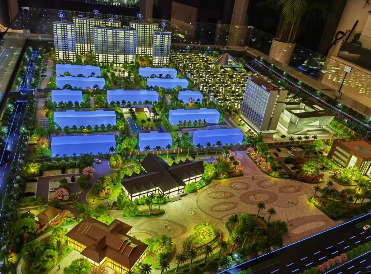
Let us break down what makes a model effective for station‑area planning.
Station and Track Layout
Platforms, concourse, entrances, taxi stands, bus bays, bike parking.
Detailed enough to show passenger flow.
Transit‑Oriented Development (TOD) Zones
High‑density residential (yellow‑orange), office (blue), hotel (purple), retail (red), mixed‑use (orange).
Color‑coded within walking distance of the station.
Multimodal Connections
Feeder bus routes, light rail, bike‑share stations, pedestrian bridges, ride‑share pickup zones.
Clear connections to the wider city.
Economic Impact Zones
Business parks, convention centers, innovation districts.
Highlighted as anchors.
Public Spaces and Plazas
Station square, green spaces, pedestrian promenades.
Essential for placemaking.
Phasing and Development Parcels
Phase 1, 2, 3 construction zones.
Available land for future investors.
Connectivity to the Region
High‑speed rail line entering and exiting the model.
Connections to Regional Urban Planning Scale Model context.
Interactive Investment Features
Removable parcel blocks showing availability.
LEDs highlighting station entrances and TOD zones.
A well‑designed High Speed Rail Station City Planning Model answers: “How does this station become a destination, not just a pass‑through?”
Materials for High‑Speed Rail Station Models
Station models balance precision, durability, and presentation quality.
Laser‑cut acrylic – For station building and platform canopies.
3D printed resin – For signature station architecture.
Colored acrylic sheets – For TOD land use zones.
Fine sand or textured paint – For ground.
Micro LEDs – For platform lighting and transit connections.
Printed vinyl – For station labels and parcel numbers.
Magnetic base – For removable development blocks.
Avoid clutter – the station should be the visual anchor.
The Custom Production Process: Step by Step
How is a high‑speed rail station planning model made?
Here is the typical workflow.
Step 1: Station and TOD Master Plan Data
You provide station design drawings, land use plans, phasing schedules, and transit connection maps.
The model maker identifies the station’s influence zone (typically 800m radius).
Step 2: Scale Selection
Common scales: 1:500 to 1:2,000.
1:500 for a detailed station area.
1:1,000 for a larger district.
Step 3: Base and Context
A reinforced MDF base is cut.
Surrounding streets and existing buildings shown in light grey.
Step 4: Station Building and Tracks
Station modeled in high detail.
Tracks and platforms indicated.
Step 5: TOD Land Use Zones
Residential, office, hotel, retail, mixed‑use color‑coded within walking distance.
Step 6: Multimodal Connections
Bus bays, bike‑share, ride‑share zones, pedestrian bridges added.
Step 7: Public Spaces and Plazas
Station square and green spaces marked.
Step 8: Phasing and Investment Parcels
Available development sites shown as removable colored blocks.
Phase boundaries distinguished.
Step 9: Regional Context (Optional)
Simplified representation of the rail line extending beyond the model edge.
Step 10: Interactivity
LEDs highlighting station entrances and TOD corridors.
Magnetic parcel markers for investor roadshows.
Step 11: Quality Control and Cover
The model is inspected for legibility.
A low acrylic railing (not a full cover) allows close viewing.
A custom High Speed Rail Station City Planning Model typically takes 8 to 12 weeks.
Applications for High‑Speed Rail Station Models
Where are these models used?
Transit Authority Planning
Coordinate station design with surrounding development.
Investor and Developer Presentations
Show available parcels within walking distance of the station.
Public Engagement and Station Area Workshops
Residents see how the station will transform their neighborhood.
Funding and Grant Applications
Demonstrate economic returns to state and federal agencies.
TOD Zoning and Policy Development
Test density bonuses and parking requirements.
Integration with Other Planning Model Types
A Satellite Town Planning Sand Table Model might show a new town connected by high‑speed rail – your station model is the anchor.
Case Study: Station Model Attracts $800M in Private Investment
A regional authority planned a high‑speed rail station in an underdeveloped suburb.
Private developers were hesitant to invest.
They commissioned a High Speed Rail Station City Planning Model at 1:800 scale, covering a 2m x 1.8m table.
The model showed the station (detailed acrylic), five TOD zones (color‑coded), and a pedestrian promenade connecting to a new town square.
Available parcels had small green LEDs.
At an investor summit, the model was the centerpiece.
Three developers committed $800 million in mixed‑use projects.
The model cost $42,000.
The return was over 19,000 times.
Cost Factors for High‑Speed Rail Station Models
Area covered – Station only vs. station plus 800m TOD zone.
Station detail – Simple massing vs. fully detailed architecture.
Number of land use zones – 3 vs. 10.
Phasing complexity – 2 phases vs. 5 phases.
Interactivity – Static vs. magnetic parcel markers and LEDs.
Typical range: 75,000 for a large, detailed model with full TOD zoning and interactive investment features.
How to Choose a Model Maker for Station Projects
Experience with transit station models – Not just general urban planning.
Ability to detail station architecture – Canopies, platforms, entrances.
Understanding of TOD principles – Walking distance, density gradients.
References from transit authorities – Call two.
Ask for a sample of a station model with surrounding land use zones.
Maintaining and Updating Your Station Model
Station areas evolve as parcels are developed.
Use magnetic development blocks – Replace “planned” with “built” blocks.
Replaceable parcel status stickers – Update availability colors.
Annual review – Compare to current leasing and construction.
Budget for updates – Every 1‑2 years for active TOD zones.
For an Urban Green Space Planning Scale Model that includes a station plaza, the same modular approach works.
Display Tips for Maximum Impact
In a Transit Authority Office
Low pedestal with even lighting.
A legend showing TOD land use colors and phasing.
For Investor Roadshows
Place the model on a wheeled cart.
Use portable LED lights to highlight available parcels.
For Public Hearings
Provide laser pointers (non‑laser for safety).
Hand out takeaway brochures with the same land use colors.
Common Mistakes to Avoid
Do not forget the walking distance radius.
The model should clearly show what is within 5‑10 minutes of the station.
Do not ignore multimodal connections.
Bus, bike, and ride‑share are essential for TOD.
Do not make the station too small.
The station is the anchor – it should stand out.
Do not use the same color for different land uses.
Office, hotel, retail, and residential must be distinguishable.
Do not skip a legend.
Without a legend, viewers cannot interpret the TOD zones.
Integrating with Other Planning Model Types
A high‑speed rail station model works alongside specialized models for different scales.
For the broader region, a Regional Urban Planning Scale Model shows the high‑speed rail corridor – your station model is the node.
For city infrastructure, a City Infrastructure Planning Sand Table Model coordinates roads and utilities around the station – your model provides the land use context.
For a new community connected by the station, a Satellite Town Planning Sand Table Model plans the housing – your model shows the employment center.
For underground systems, a Municipal Engineering Planning Sand Table Model adds water, sewer, and power – your model shows the surface development.
For green networks, an Urban Green Space Planning Scale Model adds station plazas and greenways – your model includes the public spaces.
Each type serves a different purpose. The high‑speed rail station model is the catalyst for transit‑oriented growth.
Future Trends in High‑Speed Rail Station Sand Table Models
Real‑time train data – LEDs show train arrivals and platform congestion.
Augmented reality – Scan a parcel to see proposed building designs.
Modular station expansions – Swap out platforms for future track additions.
Sustainability overlays – Show solar canopies and green roofs on station buildings.
Yet the core remains.
Investors and planners need to see the station as a place, not just a line on a map.
A physical model does that best.
Conclusion
A High Speed Rail Station City Planning Model is a powerful tool for unlocking transit‑oriented development.
It attracts investment, coordinates land use, and builds public support.
Focus on station detail, TOD land use zones, and walking distance.
Add interactive parcel markers for investor roadshows.
Plan for updates as the station area develops.
Whether you are a transit authority, urban planner, or developer, invest in a station model.
Your station will become a destination.
Your city will grow around it.
And remember – whether you need a Satellite Town Planning Sand Table Model for a connected community, an Urban Green Space Planning Scale Model for station plazas, a City Infrastructure Planning Sand Table Model for surrounding roads and utilities, a Municipal Engineering Planning Sand Table Model for underground systems, or a Regional Urban Planning Scale Model for the rail corridor, each supports the station vision. But for the integrated station‑area plan itself, the dedicated high speed rail station city planning model is essential.
Model your station. Launch a new urban center.


