County Town Urban Planning Scale Model
Introduction
County towns are unique.
They serve as administrative hubs for surrounding rural areas.
Unlike big cities, they must balance urban growth with agricultural land, small‑town character, and limited budgets.
How do you plan a county town that grows sustainably?
Digital maps miss the human scale.
You need a physical model.
That model is a County Town Urban Planning Scale Model.
This guide explains why county towns need dedicated planning models.
What features to include.
And how to use them for balanced, community‑focused growth.
Let us begin.
What Is a County Town Urban Planning Scale Model?
It is a physical miniature of a county seat and its immediate hinterland.
Built on a sand‑textured base.
A County Town Urban Planning Scale Model shows the town center, residential neighborhoods, industrial zones, agricultural land, transportation links, and public facilities.
Unlike a metropolitan model, this one emphasizes the interface between town and country.
Where does the built area end and farmland begin?
How do rural residents access hospitals and schools?
The model is used by county planning departments, elected county boards, and rural development agencies.
Why County Towns Need a Dedicated Model
County towns face pressures unique to their scale.
Too much growth destroys character.
Too little growth starves the local economy.
A County Town Urban Planning Scale Model helps planners see the balance.
They identify infill sites within existing boundaries.
They protect open space and agricultural land at the edges.
Also, the model supports grant applications.
State and federal rural development funds require clear visualizations.
For public engagement, a model helps farmers and small‑town residents understand future changes.
Key Features of a County Town Planning Model
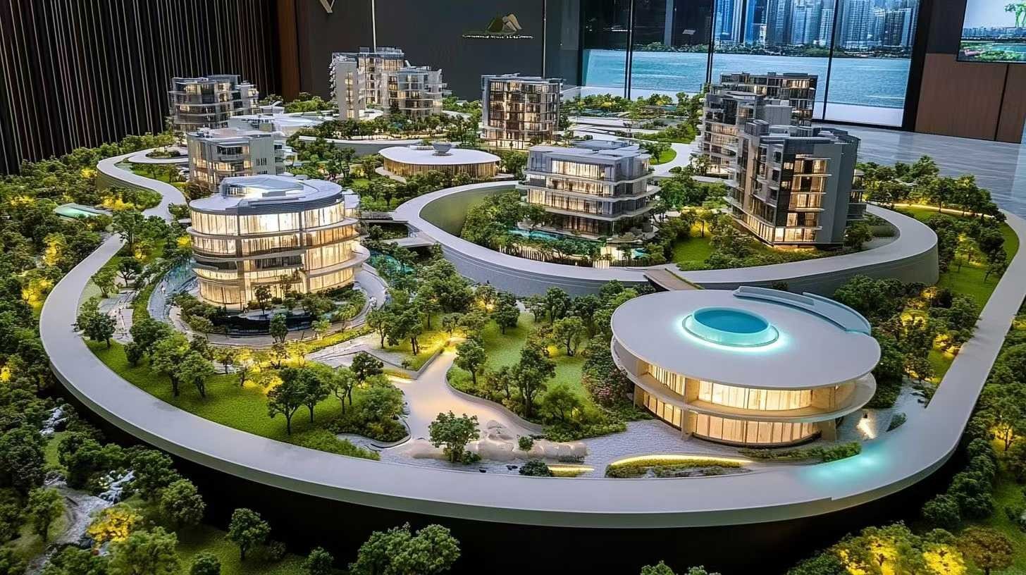
Let us break down what makes a model effective for county town planning.
Town Center and Main Street
Historic commercial core, county courthouse, post office, library.
Highlighted as the civic heart.
Residential Neighborhoods
Existing housing areas and planned subdivisions.
Density indicated by color or texture.
Agricultural and Rural Buffers
Farmland, woodlands, open space at the town edge.
Green zones that limit sprawl.
Industrial and Commercial Zones
Light industrial parks, agri‑business facilities, retail corridors.
Separated from residential areas.
Transportation Links
State highways, county roads, rural bus routes, rail lines (if any).
Connects the town to surrounding communities.
Public Facilities
County hospital, high school, fire station, sheriff’s office, community center.
Essential for rural service delivery.
Growth Phasing and Infill Areas
Phase 1, 2, 3 within existing boundaries.
Infill sites shown as available parcels.
Natural Features and Floodplains
Creeks, rivers, wetlands, steep slopes.
Hazard areas highlighted.
Interactivity
Removable development blocks for scenario testing.
LEDs to highlight priority infrastructure.
A well‑crafted County Town Urban Planning Scale Model answers: “How does this town grow without losing what makes it special?”
Materials for County Town Models
County town models balance detail and cost.
Laser‑cut MDF or acrylic – For building massing blocks.
Colored acrylic sheets – For land use zones.
Fine sand or textured paint – For ground and agricultural areas.
Green flocking – For parks and rural buffers.
Printed vinyl – For labels and growth boundaries.
Small icons – For public facilities.
Removable overlays – For phasing scenarios.
Avoid overly complex detailing – readability is key.
The Custom Production Process: Step by Step
How is a county town planning scale model made?
Here is the typical workflow.
Step 1: County Data Compilation
You provide comprehensive plan maps, zoning ordinances, agricultural preservation areas, infrastructure plans, and population projections.
The model maker identifies key growth constraints.
Step 2: Scale Selection
Common scales: 1:2,000 to 1:10,000.
1:2,000 for a detailed downtown.
1:5,000 for the whole town and immediate rural fringe.
Step 3: Base and Topography
A reinforced MDF base is cut.
Rivers, creeks, and hills sculpted (referencing a Urban Landscape Planning Sand Table Model for natural features).
Step 4: Town Center and Landmarks
Main street, courthouse, and historic buildings given prominence.
Step 5: Land Use Zones
Residential (yellow), commercial (red), industrial (blue), agricultural (green), public (purple).
Step 6: Rural Buffers and Open Space
Farmland and conservation areas shown in light green.
Step 7: Transportation and Infrastructure
Roads, bus routes, and utility corridors added.
Step 8: Public Facilities
Hospitals, schools, fire stations marked with icons.
Step 9: Floodplains and Hazard Areas
Blue overlays for flood zones.
Step 10: Growth Phasing
Infill areas and future expansion boundaries distinguished.
Step 11: Interactivity
Removable development blocks for “what if” scenarios.
Step 12: Quality Control and Cover
The model is inspected for legibility.
A clear acrylic cover is recommended.
A custom County Town Urban Planning Scale Model typically takes 8 to 12 weeks.
Applications for County Town Models
Where are these models used?
Comprehensive Plan Updates
Guide decisions on growth boundaries and land use.
Zoning and Subdivision Reviews
Assess proposed developments against the plan.
Grant Applications for Rural Development
Demonstrate need for water, sewer, or broadband infrastructure.
Public Hearings and Town Meetings
Farmers and residents point at the model.
Trust increases when changes are visible.
Economic Development Strategy
Show available industrial sites to potential employers.
Integration with Other Planning Models
A New Energy City Planning Scale Model might add solar farms on county land – your model shows where they fit.
Case Study: County Town Model Prevents Sprawl and Wins Grant
A county town of 15,000 residents faced pressure for cheap housing on farmland.
Developers proposed subdivisions beyond the existing urban boundary.
The county planning department commissioned a County Town Urban Planning Scale Model at 1:4,000 scale, covering a 2m x 2m table.
The model showed the urban growth boundary (red line), infill sites (yellow blocks), and protected farmland (green).
At a public hearing, residents saw that 200 infill lots were available inside the boundary.
The board denied the sprawl proposal.
A state grant for downtown revitalization was awarded – the model helped visualize the compact growth strategy.
The model cost 3 million.
Cost Factors for County Town Models
Area covered – Town only vs. town plus rural fringe.
Detail level – Basic land use vs. parcel‑level zoning.
Agricultural preservation features – Simple green zones vs. detailed farmland classification.
Interactivity – Static vs. removable development blocks.
Typical range: 55,000 for a detailed county town model with rural buffers and phasing.
How to Choose a Model Maker for County Projects
Experience with small‑city or rural planning – Not just large metros.
Ability to show urban‑rural interface – Growth boundaries and farmland buffers.
Understanding of county governance – Multiple jurisdictions.
References from county planning departments – Call two.
Ask for a sample of a model showing an urban growth boundary and infill sites.
Maintaining and Updating Your County Town Model
Comprehensive plans are updated every 5‑10 years.
Use removable growth boundary overlays – Adjust as policies change.
Replaceable development blocks – Update infill sites.
Annual review – Compare to new census data.
Budget for major update – Every 5 years for plan revision.
For a Historical City Protection Planning Model that includes the county town’s historic district, the same modular approach works.
Display Tips for Maximum Impact
In a County Planning Office
Low pedestal with even lighting.
A legend showing land use colors and growth boundary.
For Public Town Meetings
Place the model on a rolling cart.
Use laser pointers (non‑laser for safety).
Provide printed takeaway maps.
At County Board Hearings
Highlight infill sites and proposed projects.
Common Mistakes to Avoid
Do not forget the rural fringe.
The relationship between town and farmland defines county town character.
Do not make the growth boundary invisible.
Use a bold red dashed line.
Do not ignore floodplains.
Small towns are often in river valleys.
Do not over‑detail individual buildings.
Focus on land use patterns.
Do not skip a legend.
Without a legend, residents cannot distinguish industrial from agricultural zones.
Integrating with Other Planning Model Types
A county town model works alongside specialized models for different aspects.
For a town planning a renewable future, a New Energy City Planning Scale Model adds solar farms and energy efficiency – your model shows the land use context.
For heritage protection, a Historical City Protection Planning Model highlights the historic Main Street – your model integrates it with modern growth.
For a broader region, an Urban Cluster Planning Sand Table Model shows how the county town connects to neighboring towns – your model is the detailed local view.
For public display, a Government Exhibition Urban Planning Sand Model can feature the county town plan at a county fair or visitor center.
For natural features, an Urban Landscape Planning Sand Table Model adds tree canopy and greenways – your model includes those as part of the rural buffer.
Each type adds depth. The county town model is the practical tool for small‑city planning.
Future Trends in County Town Sand Table Models
Live agricultural data – LEDs show crop types or irrigation status.
Augmented reality – Scan a parcel to see soil quality or development history.
Modular infill blocks – Swap proposed projects as funding arrives.
Broadband infrastructure layers – Show fiber optic coverage gaps.
Yet the core remains.
County planners need to see the balance between town and country.
A physical model does that best.
Conclusion
A County Town Urban Planning Scale Model is an essential tool for balanced, sustainable growth in small cities.
It protects farmland, directs development inward, and builds community trust.
Focus on growth boundaries, rural buffers, and infill sites.
Add floodplain and infrastructure layers.
Use the model in every public hearing.
Whether you are a county planner, elected official, or rural development specialist, invest in a county town model.
Your town will grow smarter.
Your rural character will endure.
And remember – whether you need a New Energy City Planning Scale Model for renewables, a Historical City Protection Planning Model for heritage, an Urban Cluster Planning Sand Table Model for regional context, a Government Exhibition Urban Planning Sand Model for public display, or an Urban Landscape Planning Sand Table Model for green spaces, each can serve a county town. But for the integrated vision of a small city and its rural surroundings, the dedicated county town urban planning scale model is irreplaceable.
Model your county town. Grow with character.


